










KŌLOGY · Màn hình & chức năng
House numbers on the map
Plate number (jūkyo hyōji) in a blue box; land lot number (chiban) in brown with 番地.
Bài viết này chưa được dịch sang ngôn ngữ của bạn: đang hiển thị bản English.
Trong trang này
Reading the numbers
- Blue box = the house PLATE number (jūkyo hyōji, the gō on poles and walls). At street zoom you see the block (gaiku); closer, the gō; very close, block-gō.
- Brown with 番地 = the land registry lot number (chiban). Used where the city has no jūkyo hyōji; hidden next to a plate number to avoid confusion.
- No number shown = no public data for that spot. The app never invents a number.
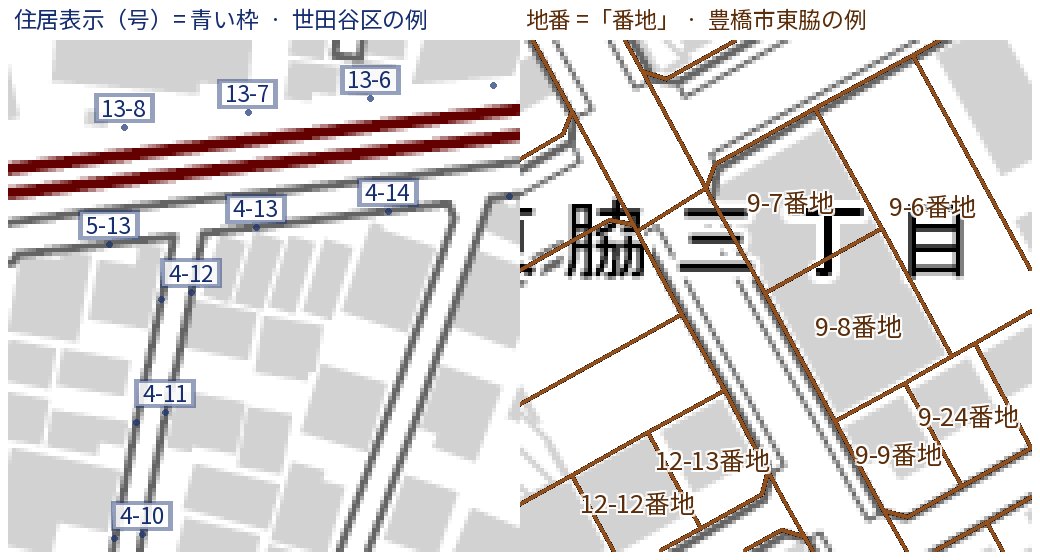
Coverage: all of Japan. Toggle with “with numbers” in the map picker. Sources: Address Base Registry (Digital Agency, CC BY 4.0) and MOJ registry maps (CC BY 4.0).
App map: STAFFS and Routes
- Open the manager’s middle tab and choose STAFFS. Zoom in until streets and lots are visible.
- Open the map selector and enable the house-number switch. KoMap shows driving details and available road names.
- You can turn layers off and back on, open Routes and return to STAFFS. The layers load again wherever you zoom.
Numbers depend on public-data coverage. 地番/番地 identifies a land lot and may differ from the number displayed on a house. Preferences are saved on this device.