











KoChiken · Pantallas y funciones
Route and navigation
Map with the KoMap layer on top, distance and ETA to the next destination; voice navigation with Google/Apple Maps.
Este artículo aún no está traducido a su idioma: se muestra la versión en English.
En esta página
Navigation
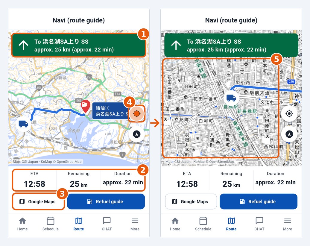
The Route tab opens Navi (route guide), which shows the route from where you are to the next destination:
- The green bar shows the destination and the approximate distance and time (1).
- At the bottom: ETA, Remaining km and Duration (2).
- Google Maps opens voice navigation (3). On iPhone there are two buttons: Google and Apple.
- The blue button is I've arrived (at a fuel stop it is Refuel guide, and the label changes as you refuel).
KoMap on the map
Every map in the app (this screen and the manager map) uses the GSI base map with the KoMap layer on top. Tap the location button (4) to zoom in on the truck: KoMap then shows driver information over the map (5) — street names and route numbers, bus stops and lines, traffic lights, stop signs, railway crossings, one-way streets, height/weight limits, parking and gas stations. The round button below it shows the whole route again. The credit "Map: GSI Japan · KoMap © OpenStreetMap" stays at the bottom of the map.
If the road route is not available, the app shows a straight line ("Road route unavailable: showing a straight line").